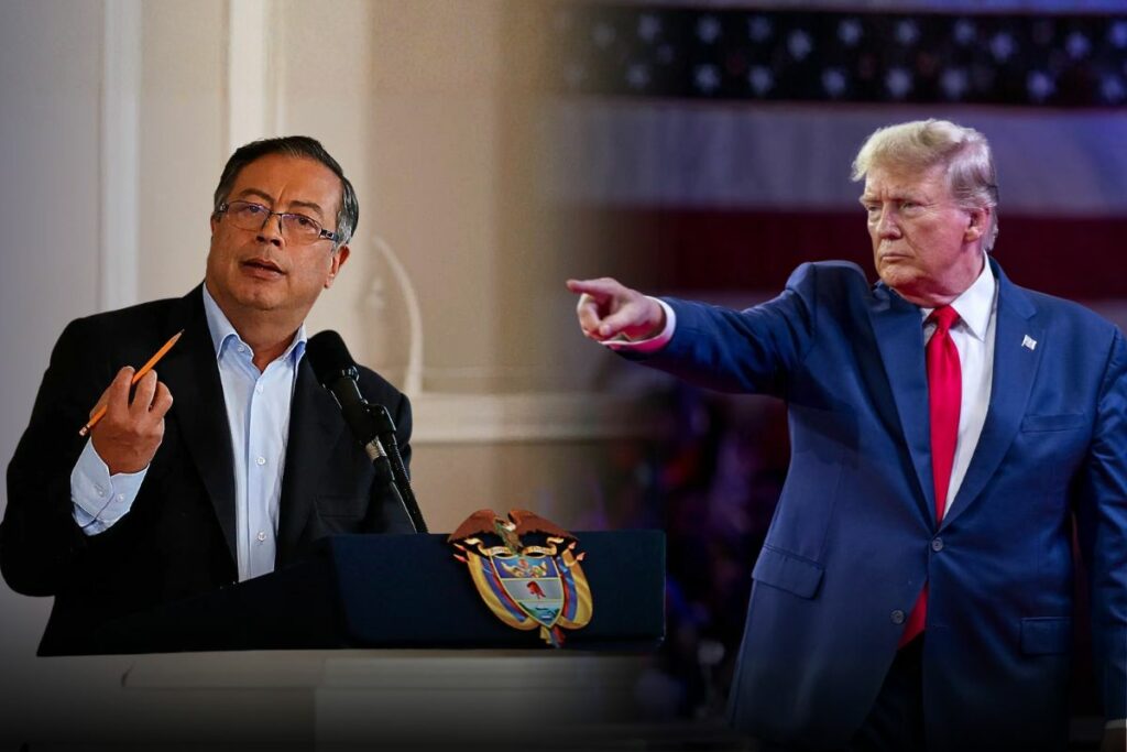
On June 12, 2025, the Congress of the Republic of Peru unanimously approved Law No. 32403, declaring the creation of the Santa Rosa de Loreto district in the Amazon. On August 5, Colombian President Gustavo Petro responded forcefully through the social network X (formerly Twitter), rejecting Peruvian sovereignty over the territory. But what is the root of this dispute?
Santa Rosa Island is located on the Amazonian border between Colombia and Peru, an area many recognize by the nickname "The Lungs of the World," and as if that were not enough, it sits on the Amazon River, the most voluminous river on Earth. This small island, since August, has given rise to a series of cross-border disagreements that brought to light the state abandonment by both countries over recent decades. Peru's announcement does not declare annexation of the island but rather reaffirms its sovereignty over it through the creation of the Santa Rosa de Loreto district, implying they have always considered it part of their territory. For its part, Colombia accuses the Peruvian government of annexing a territory that has historically been in dispute, using the Salomón-Lozano Treaty (1922) and the Rio de Janeiro Treaty (1934) as arguments.
"Colombia does not accept Peru's annexation of Santa Rosa Island..."
The Historical Treaties
The first consisted of a border agreement signed and ratified by Colombia and Peru, which ended a territorial dispute that both countries had maintained for several decades, finally establishing an agreed and fixed border line. The second upheld the ratification and execution of the Salomón-Lozano Treaty, confirming the border delimitation and adding a new criterion: the use of the Thalweg.
The Rio de Janeiro Protocol aimed to prevent future cross-border conflicts and ensure that the delimitation was fair for both Colombia and Peru. That is why they enshrined the Thalweg, the line that follows the main navigation channel, which coincides with the deepest part of the river. However, a crucial problem arises here. Since the channel varied over time and the protocol did not establish fixed coordinates, it opened the door to confusion and unilateral interpretations. The border now moved with the main channel. Understanding that this protocol does not suggest assigning the island to either of the two states and does not clarify the required action in case new islands form naturally, both countries have taken different positions.
The Opposing Positions
Peru maintains that Chinería Island is within the already-defined Peruvian border; therefore, there would be no point of discussion since the Santa Rosa district would be linked to the island.
On the other hand, Colombia suggests that Chinería Island was formed by sedimentation after the Treaties and therefore rejects any act of annexation or declaration of sovereignty over the island by Peru. At the same time, it requested the creation of a binational commission to determine its sovereignty, basing its argument on geographical changes over recent decades.
"There is no border dispute with Colombia [...]. We reiterate that there is no discussion whatsoever about Peru's sovereignty over the Santa Rosa de Loreto district, nor over any of our other borders."
The Consequences for Leticia
The conflict raises numerous questions but mainly forces citizens to ask whether this could have been avoided. Colombia's main current concern is not only whether Santa Rosa Island belongs to Peruvian or Colombian jurisdiction but rather the consequences this would have for the country. It is important to keep in mind that if the island continues growing toward the Colombian side, Leticia, the capital of Colombia's Amazon region and the only strategic river port the country has in the area, would lose its access to the river.
The Scientific Warnings
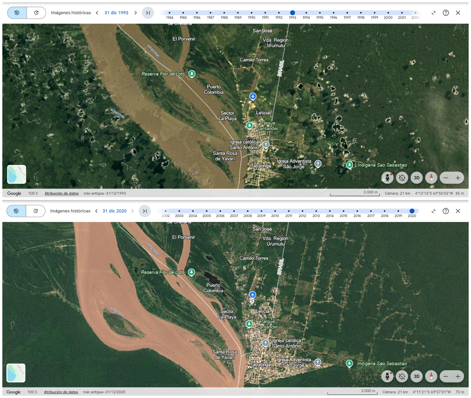
Since the end of the last century, researchers from the National University of Colombia have been pointing out a progressive transformation in the behavior of the Amazon River along the border section with Peru. Hydrological records from 1993 showed that most of the water flow crossing the Nazareth Strait was heading toward the Colombian channels. However, new measurements taken in June 2025 revealed an almost complete reversal of that dynamic: less than a fifth of the current flow continues through the Colombian arm, while the dominant volume now flows through the Peruvian side. These changes, explained by natural sedimentation processes and reconfiguration of the riverbed, had been warned by the scientific community as signs of a growing risk to Colombia's river position in the Amazon, warnings that eventually materialized.
An Ignored Project
In the mid-2000s, engineer Lilian Posada, professor at the National University of Colombia's Medellín campus, led a technical initiative aimed at halting this trend. The project proposed intervening at critical points of the channel through controlled removal of materials, with the goal of stabilizing the flow and preserving a more balanced distribution of water flow in the channels benefiting Colombia from the Nazareth Strait. Despite its preventive and technical nature, the proposal was not incorporated into public policy at the time, remaining archived during the government of Álvaro Uribe Vélez, without structural measures being adopted to address the problem.
Conclusion
What has occurred around Santa Rosa Island clearly exposes the priorities and omissions that have marked the Amazonian policy of the involved states for decades. The preservation and strategic management of the Amazon, despite its environmental, territorial, and geopolitical relevance, did not occupy a central place on the public agenda until the conflict acquired an explicit diplomatic dimension. Only when the Peruvian Congress approved a law that directly affected Colombian interests did the Colombian government decide to speak out, transforming a long-ignored scientific warning into a foreign policy matter.
Beyond the legal debate over sovereignty of an island whose formation responds to natural processes, the core of the problem lies in sustained political negligence regarding predictable and documented geographical transformations. For years, scientific studies warned about the progressive loss of water flow in the Colombian arms of the Amazon River and the risk this implied for Leticia. The absence of effective public policies, river planning, and inter-institutional coordination allowed a natural phenomenon to become a strategic vulnerability.
This scenario forces a rethinking of the approach with which states have addressed the Amazon: not only as an environmental symbol or peripheral space but as a living territory whose dynamics require timely technical decisions and sustained regional cooperation. If concrete measures are not adopted in the short and medium term, there is a real risk that Leticia will see its permanent access to the Amazon compromised, with economic, social, and geopolitical consequences that transcend the Colombian-Peruvian border and affect the Amazon basin as a whole.
In this sense, the current conflict should not be understood solely as a territorial dispute but as an opportunity to correct decades of inaction and move toward responsible, preventive, and cooperative management of the Amazon River, a resource whose importance is not only strategic for the riparian states but vital for the environmental balance of the planet.